I have been following a Coursera course on geology for the last few weeks that have been quite interesting. One fun assignment was to visit and write an essay on a geologic site in the local area. I took the opportunity to take notes and snap some pictures when I visited my parents on the island Gotland in the Baltic sea a few weeks ago. Because I put some effort into researching the topic I thought I would document my findings here.
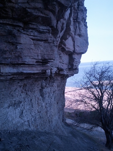
Photo 1: The selected site. A limestone outcrop at the coast.
The site
I chose the location spontaneously when I was going for a walk along the beach about 4 km north of the town Visby. The solid rock cliff shown in photo 1 is exposed next to the walking track above an approximately ten meter high slope of weathered material.
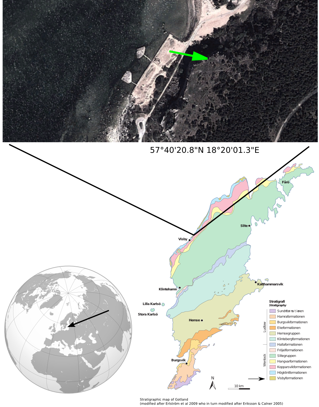
Illustration 1: Location and stratigraphic map of Gotland
The rock is visibly layered with layer thicknesses with several length scales but most noticeably 2-10 cm (see photo 2).
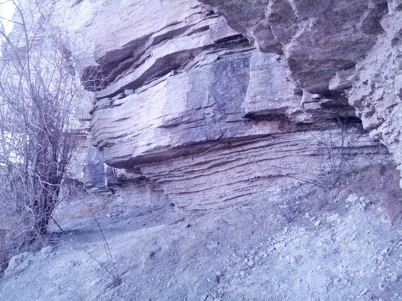
Photo 2: Visible layering. Layers are approximately 10 cm thick.
The weathering must be relatively fast because only a few smaller loose rocks lie free on the slope just below the cliff. The slope mostly consists of very fine grained almost dissolved material with a clay like cohesive structure with high water content.
A rock was taken home from the site for further analysis (shown in photo 3).
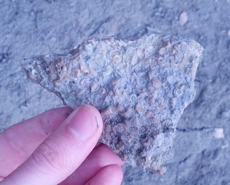
Photo 3: Typical rock found on the slope below the cliff with clearly visible fossils.
Analysis
The local creation myth has it that the island Gotland was once cursed and sank into the sea every morning as the sun rose only to rise again during the night Gutasaga. The magic was broken when a man called Tjelvar brought fire to the island. There is a grain of truth in the myth because the island of Gotland has been under water many times throughout its geological history (Svantesson, 1978).
The island bedrock consists of calcium rich sedimentary rocks, mainly limestone, marl and sandstone, that formed from deposition of marine lifeforms that prospered when Gotland laid under a warm shallow sea close to the equator 600-400 million years ago (Svantesson, 1978). The rock layer currently at the surface formed under a 10 million year time period during the silurian age and comprises a layer about 600 meter thick (Swedish geological survey (SGU), 2009).
How the rocks at the site formed
The site lies on the north west coast of the island (about 4 km north of Visby). As can be seen on the Stratigraphic map shown in illustration 1 the rock formations present in the region are the Visby formation and the Högklint formation of limestone. The SGU report that the Visby formation can be observed in the cliffs along the north west cost as a few meter thick layer of alternating marl and limestone with internal layers of thicknesses 1-10 cm. On top of the Visby formation lies the Högklint formation which consists of harder limestone that shows much more irregular layering. This description agrees well with my observations from the site so I conclude that what is seen as the lower few meters in photo 4 is an outcrop of the Visby formation and the formation above is an outcrop of the Högklint limestone. According to the SGU the Visby formation formed when the area was in protected waters i.e., a lagoon or similar. The Högklint limestone formed when the area for some reason had become a reef. A model of how the environmental conditions result in different rock types were given by SGU and is shown annotated by me in illustration 2.
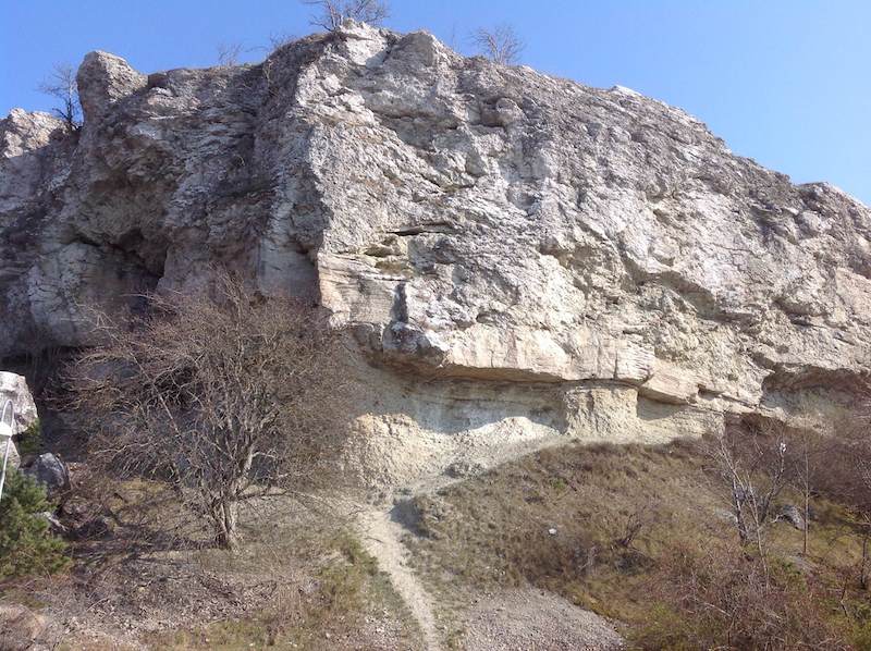
Photo 4: There are two rock formations clearly distinguishable in the cliff
face. At the bottom a softer limestone with regular layering and on top a
harder and more irregular limestone. These are likely the Visby formation and the
Högklint formation.
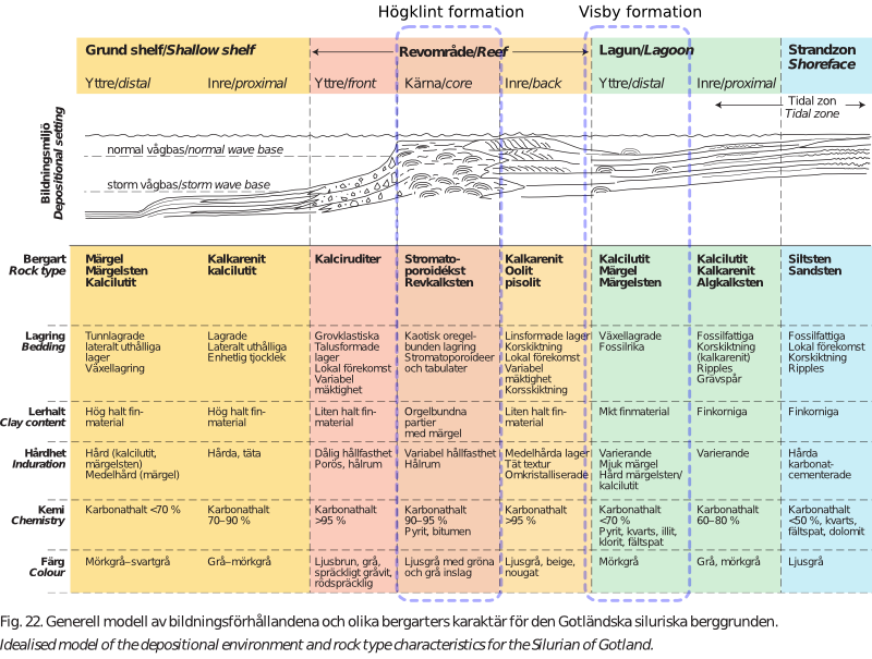
Illustration 2: Conditions in which the different calcium rich rock types form
How the cliff got its form
The costal regions have experienced heavy erosion from the waves of the sea when the sea level was higher than it is today (Svantesson, 1978). The cliff under investigation likely got its present day appearance during the time of the Littorina sea about seven thousand years ago when the sea level was up to 25 meters higher than it is today. That meant that the cliffs were directly exposed to the seas (SGU 2009). The softer Visby marl has been particularly eroded during this time which led to the fact that the Högkint limestone overhangs (see illustration 3).
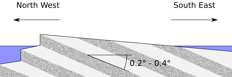
Illustration 3: A model of how the cliff formation occur on the north west
coast of Gotland due to the dip of the strata. (Adopted from Svantesson, 1978)
Clearly erosion is also happening today. The marl in the Visby formation layer is moist because of ground water leakage (see photo 5). The presence of carbonic acid in the ground water leads leads to dissolution of the calcium carbonate which weathers the rock.
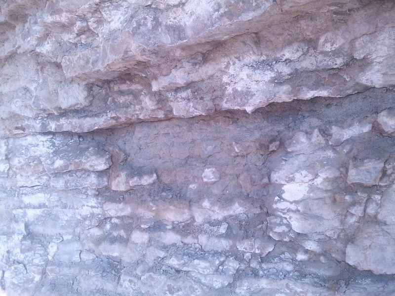
Photo 5: In the lower formation the layers alternate between limestone and
marl. In the center of the picture there is a wet spot, indicating ground water leakage.
Classification of the rock I collected
The rock that was collected is likely a limestone from the Visby formation because it was found under the overhang and it has the expected layered structure and the fine grained structure of the rock. Having been classified as belonging to the Visby formation the rock can be dated to be between 428 and 426 million years old (SGU, 2009).
Comparing the fossils found with pictures found in a book about Gotland fossils (Brood, 1982) and after discussions on the Coursera forum I believe I have identified three types of fossils in the rock sample: Rugose corals, Crinoids and Sponges, as is shown in photo 6.
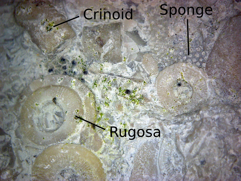
Photo 6: Detail of the rock that I hold in the picture above that shows a set of
fossils embedded in a white matrix. I believe these species belong to the now
extinct Rugose order of corals.
References
-
Erlström et al, Swedish Geological Survey, Beskrivning till regional berggrundskarta över Gotlands län (trans. Description to regional bedrock map of Gotland county), 2009
-
Brood, Krister, Gotländska fossil, 1982
-
Svantesson, Sven-Ingemund, Länstyrelsen i Gotlands Län, Översiktlig naturinventering: Geologi (trans. County administrative board, Overview of nature inventory: Geology), 1978
-
Gutasaga, Wikipedia, 2014